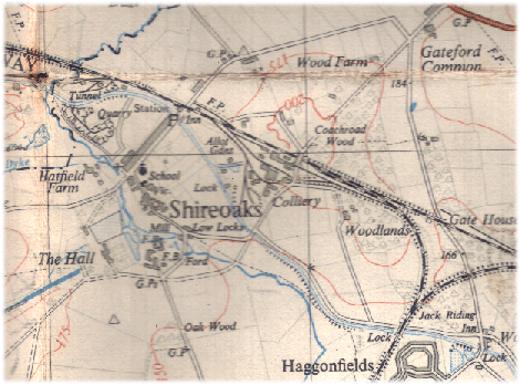
Shireoaks is only a mile or two west of Worksop and since the local A57 dual carriageway is effectively a Shireoaks bypass, and it's not really on the way to or from anywhere in particular, it is a relatively quiet and traffic free backwater. It also has the Chesterfield canal running through it only a few metres from the Sheffield to east coast railway (both seen also in such proximity at Kiveton Park Station). If you're into canals, the locks are worth a visit, you can get there in a canal narrowboat (not widebeam), but mind the blokes fishing on its banks.
It's a mixture of mostly mid 19th to late 20th century houses, from fairly large detached to brick terraces probably built to house coal miners 150 or more years ago (the pit was sunk circa 1855). All that remains of the pit are traces of its spoil heaps (the 'pit tip') and a monument over the old 480 metre (circa 1,500 ft) deep mine shaft. With the bypass and the pit closure Shireoaks seems an attractive and quiet backwater in the edge of some great countryside and cycle paths. As with many places on this site, traces of its old core remain around the mock gothic church (circa 1861), with 18th century stone buildings and farms, plus a genteelly decaying stone manor house, a couple of pubs, and some fishing ponds.