The Cuckoo way walk/bike ride
When the canal was renovated and made passable along all its length, a 46 mile walk was formally created - the Cuckoo Way that runs from the West Stockwith Lock, River Trent, Notts to Chesterfield in Derbyshire, passing through South Yorkshire. The canal bit around Killamarsh is pretty much filled in nowadays, although there are plans to route it through Rother valley Country Park. And the bit from Killmarsh to Chesterfield isn't navigable by boat as at 2011. To be honest, if I were doing it as at 2011 I'd do the more or less fully renovated 40 mile Kiveton to Stockwith leg (unless you're a completist!). The Cuckoo Way intersects the Trans Pennine Trail at Rother Valley/Killamarsh from where you walk back east in the direction of Hull if you're into a really big circular hike.
As it's a towpath/bridleway much of the route can be done on a mountain bike, as is the Trans pennine trail.
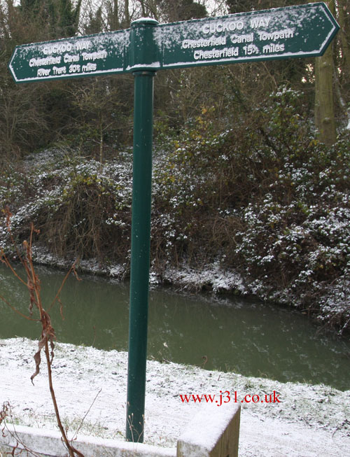
It was possible to make most of the walk before the canal's renovation, but the towpath was jungle like and derelict in many places. And now it's nicely signposted so that you know where you are, and how far it is to the next pub or town.
As walks go the Kiveton -> West Stockwith leg is a pretty easy going 38 mile 2 or 3 day stroll (4 if you want to take it really steady) through rural Nottinghamshire and South Yorkshire, passing through the towns of Retford and Worksop, plus villages like Shireoaks. As it's along a canal towpath there are no really difficult slopes or rough terrain. the Pennine Way or Ben Nevis it ain't.
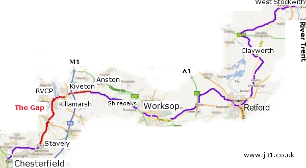
The Kiveton/Rother Valley end is near the railway stations at Kiveton Park and Kiveton Bridge (Sheffield - Lincoln line), and on loads of bus routes to Sheffield/Rotherham etc. so that may be a good place to finish the walk. although if you're on a mountain bike I assume you'd have to make speacial arrangements to get them on a train.
The Chesterfield Canal trust has more details. The Long Distance walkers Association lists all the relevant Ordnance Survey maps.
Incidentally, it's called the Cuckoo Way because the distinctive narrow boats that plied it back in the 1800s and 1900s were called Cuckoos.