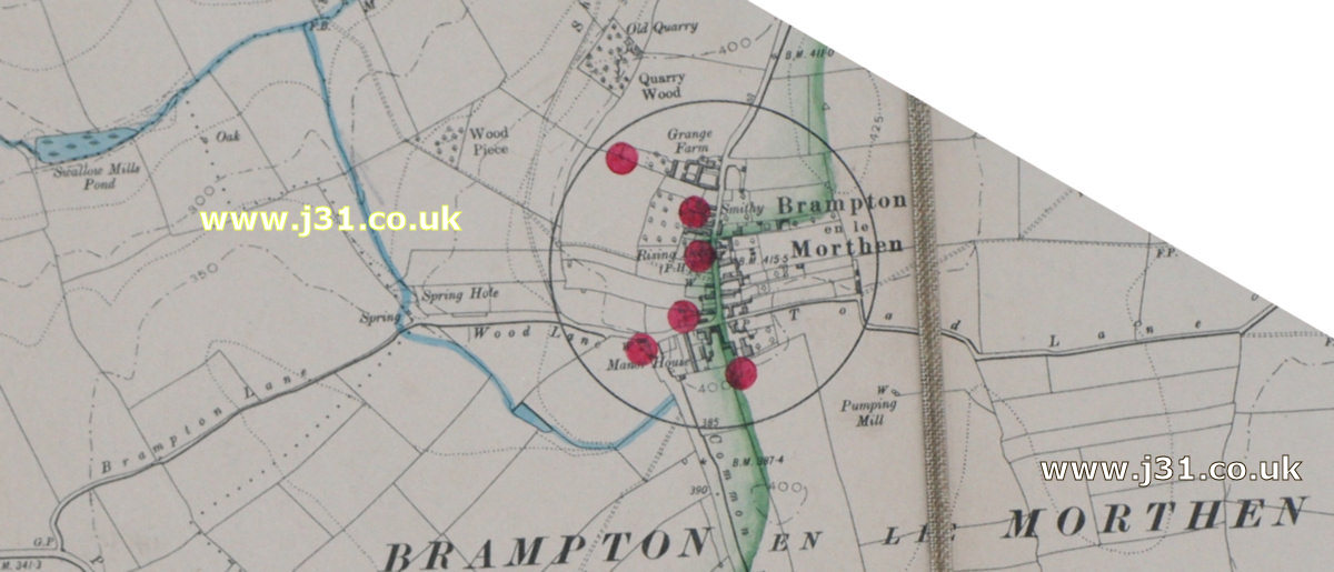
This is a map of Brampton in 1905. It's taken from a map of the watershed of Ulley Reservoir by Rotherham council. Which is why there's such an emphasis on brooks (in blue) and, er, other water courses. The red dots are 'pollution points' possibly sewers. The green line denotes Ulley ponds' watershed - all waters to the left flow to Ulley (to the right to Ryton brook).Brampton looks fairly similar then as now, although nearby Thurcroft didn't exist in 1905.